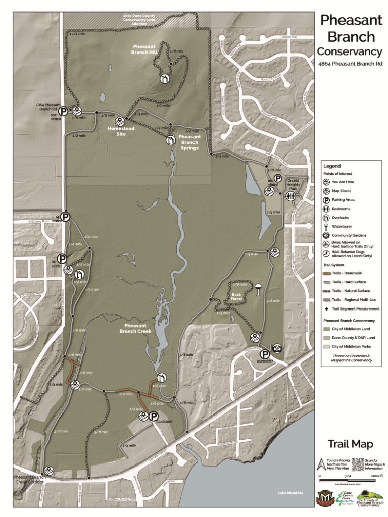
Over the last several months the City of Middleton, in collaboration with Dane County Parks and the Friends, have developed a new wayfinding map for Pheasant Branch Conservancy. Wayfinding includes all the means by which we orient ourselves within a physical space and navigate from point to point. A wayfinding map emphasizes landmarks, trailheads, trail routes and distances. It avoids clutter with too many points-of-interest or amenities that do not facilitate navigation. Our objective is to include geographic information relevant to Conservancy visitors while maintaining clarity and usability for wayfinding.
The map will be printed on 18” x 24” signs and installed at 9 locations in the Conservancy. It portrays the Conservancy as a contiguous unit with a subtle distinction between city/county jurisdictions. Trailheads, parking lots (with number of spaces,) and major landmarks are depicted. Trails are denoted as hard surface (paved or limestone,) natural surface (dirt, unimproved, seasonal,) and boardwalk to provide basic accessibility information; supplemental maps with details on the location of and distance between benches will be available online at the advice of the Senior Advisory Council. Additional supplemental maps can be produced for other users and applications if warranted.
Updating our maps of Pheasant Branch Conservancy has been a long-term objective of the Friends Accessibility and Use Committee. We are thrilled to see the final product installed later this spring!